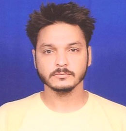
Dr. Naveen Chandra

Dr. Naveen Chandra
Designation : Scientist ‘B’
Phone : 9760030791
E-mail : naveenchandra[at]wihg[dot]res[dot]in
-
Google Scholar Page
-
Research Group
Geomorphology, Environment and Engineering Geology -
Field Of Specialization
Machine Learning, Remote Sensing, and Hazard Assesment -
Academic Qualification
-
Ph.D.
-
M.Tech
-
B.Tech
-
-
Professional Experience
Year Experience 28-04-2022 to present Scientist-B, Wadia Institute of Himalayan Geology, Dehradun, India. 01-01-2018 to 31-03-2022 Assistant Professor, Department of Computer Science and Engineering, Nanhi Pari Seemant Engineering Institute, Pithoragarh, Uttarakhand, India -
Visiting Positions
INSA Visiting Scientist, IIT Indore -
Services
None -
Awards/Fellowships/Honors/Memorial Lectures
-
MHRD fellowship for Doctoral Programme. (2013-2017)
-
MHRD fellowship for Master’s Programme. (2010-2012)
-
-
Countries Visited
None -
National/International (outside CSIR-NGRI) Collaboration
-
Department of Civil Engineering, Indian Institute of Technology, Indore, India
-
Department of Computer Science, COEP Technological University, Pune, Maharashtra, India.
-
Computer Science and Engineering, Graphic Era Deemed University, Dehradun, Uttarakhand, India.
-
Remote Sensing and GIS Lab, Department of Geology, Institute of Science, Banaras Hindu University, Varanasi, Uttar Pradesh, India
-
Department of Geosciences, University of Padova, Padova, Italy
-
Department of Earth and Environment, Boston University, Boston, USA
-
Centre for Advanced Modelling and Geospatial Information Systems, Faculty of Engineering and IT, University of Technology Sydney, Australia
-
Department of Computer Science, Big Data Algorithm Group, University of Salzburg, Austria
-
State Key Laboratory of Geohazard Prevention and Geoenvironment Protection, College of Computer Science and Cyber Security, Chengdu University of Technology, Chengdu, China
-
Geotechnical and Earth Resources Engineering, School of Engineering and Technology
-
Asian Institute of Technology, Thailand.
-
Phenikaa University, Vietnam.
-
-
List Of Publications
- Chandra, N., Vaidya, H., Satyam, N., Tang, X., Singh, S., Meena, S.R., (2025). A Novel Multi-Layer Attention Boosted YOLOv10 Network for Landslide Mapping Using Remote Sensing Data, Transactions in GIS, Wiley.
- Chandra, N., Vaidya, H., Sawant, S., & Meena, S. R. (2024). A Novel Attention-Based Generalized Efficient Layer Aggregation Network for Landslide Detection from Satellite Data in the Higher Himalayas, Nepal. Remote Sensing, 16(14), 2598.
- Chandra, N., & Vaidya, H. (2024). Automated detection of landslide events from multi-source remote sensing imagery: Performance evaluation and analysis of YOLO algorithms. Journal of Earth System Science, 133(3), 1-17.
- Chandra, N., & Vaidya, H. (2024). Deep learning approaches for landslide information recognition: Current scenario and opportunities. Journal of Earth System Science, 133(2), 1-25.
- Chandra, N., Sawant, S., & Vaidya, H. (2023). An Efficient U-Net Model for Improved Landslide Detection from Satellite Images. PFG–Journal of Photogrammetry, Remote Sensing and Geoinformation Science, 91(1), 13-28.
- Chandra, N., Vaidya, H., & Ghosh, J. K. (2022). Human cognition-based framework for detecting roads from remote sensing images. Geocarto International, 37(8), 2365-2384.
- Chandra, N., Ghosh, J. K., & Sharma, A. (2019). A cognitive framework for road detection from high-resolution satellite images. Geocarto International, 34(8), 909-924.
- Chandra, N., & Ghosh, J. K. (2018). A cognitive viewpoint on building detection from remotely sensed multispectral images. IETE Journal of Research, 64(2), 165-175.
- Chandra, N., & Ghosh, J. K. (2017). A cognitive method for building detection from high-resolution satellite images. Current Science, 1038-1044.
- Chandra, N., & Vaidya, H. (2024, December). Attention Driven YOLOv9 for Landslide Mapping in Higher Himalayas Using Satellite Images. In 2024 IEEE India Geoscience and Remote Sensing Symposium (InGARSS) (pp. 1-4). IEEE
- Chandra, N., & Vaidya, H. (2024, June). Satellite-Based Landslide Event Detection Leveraging EfficientDet Model. In 2024 International Conference on Computer, Electronics, Electrical Engineering & their Applications (IC2E3) (pp. 1-4). IEEE.
- Chandra, N., & Vaidya, H. (2023, December). Attention-Based YOLOv5 Model For Enhancing Landslide Detection In Remote Sensing Imagery. In 2023 IEEE India Geoscience and Remote Sensing Symposium (InGARSS) (pp. 1-4). IEEE.
- Chandra, N., & Vaidya, H. (2023, December) Landslide Information Extraction in Multiple Satellite Datasets Based on YOLO-NAS model. 6th World Congress on Disaster Management, Dehradun. (In proceedings)
- Chandra, N., & Vaidya, H. (2022, March). Human Cognition Based Models for Natural and Remote Sensing Image Analysis. In International Conference on Machine Intelligence and Signal Processing (pp. 617-628). Singapore: Springer Nature Singapore.
- Chandra, N., & Vaidya, H. (2022). Human Saliency Based Object Detection from Natural Images. In Data, Engineering and Applications: Select Proceedings of IDEA 2021 (pp. 113-128). Singapore: Springer Nature Singapore.
- Chandra, N., & Ghosh, J. K. (2016, October). A cognitive perspective on road network extraction from high-resolution satellite images. In 2016 2nd International Conference on Next Generation Computing Technologies (NGCT) (pp. 772-776). IEEE.
- Chandra, N., Ghosh, J. K., & Sharma, A. (2016, April). A cognitive-based approach for building detection from high-resolution satellite images. In 2016 International Conference on Advances in Computing, Communication, & Automation (ICACCA)(Spring) (pp. 1-5). IEEE.
- Chandra, N., Ghosh, J. K., & Sharma, A. (2016, April). A cognitive-based approach for building detection from high-resolution satellite images. In 2016 International Conference on Advances in Computing, Communication, & Automation (ICACCA)(Spring) (pp. 1-5). IEEE.
- Chandra, N., Sharma, A., & Ghosh, J. K. (2016, April). A cognitive method for object detection from aerial images. In 2016 International Conference on Computing, Communication, and Automation (ICCCA) (pp. 327-330). IEEE.
-
Photograph

